From The Pall Mall Gazette, 26 January 1888.
*
Where West Cumbria begins is beyond the fells. In certain places, if we think of how it is that we determine the edge of places, the boundary that separates them from someplace else has been the result of the efforts of administrators and planners, drawing on the knowledge of historians and mapmakers.[i] In other cases, natural landscape features such as rivers, valleys, and mountain ranges establish the limits of a place as some kind of barrier or obstacle. But we should not think that the way places have been represented simply mirrors reality, because there is always an active attempt to construe and construct lived space.[ii]
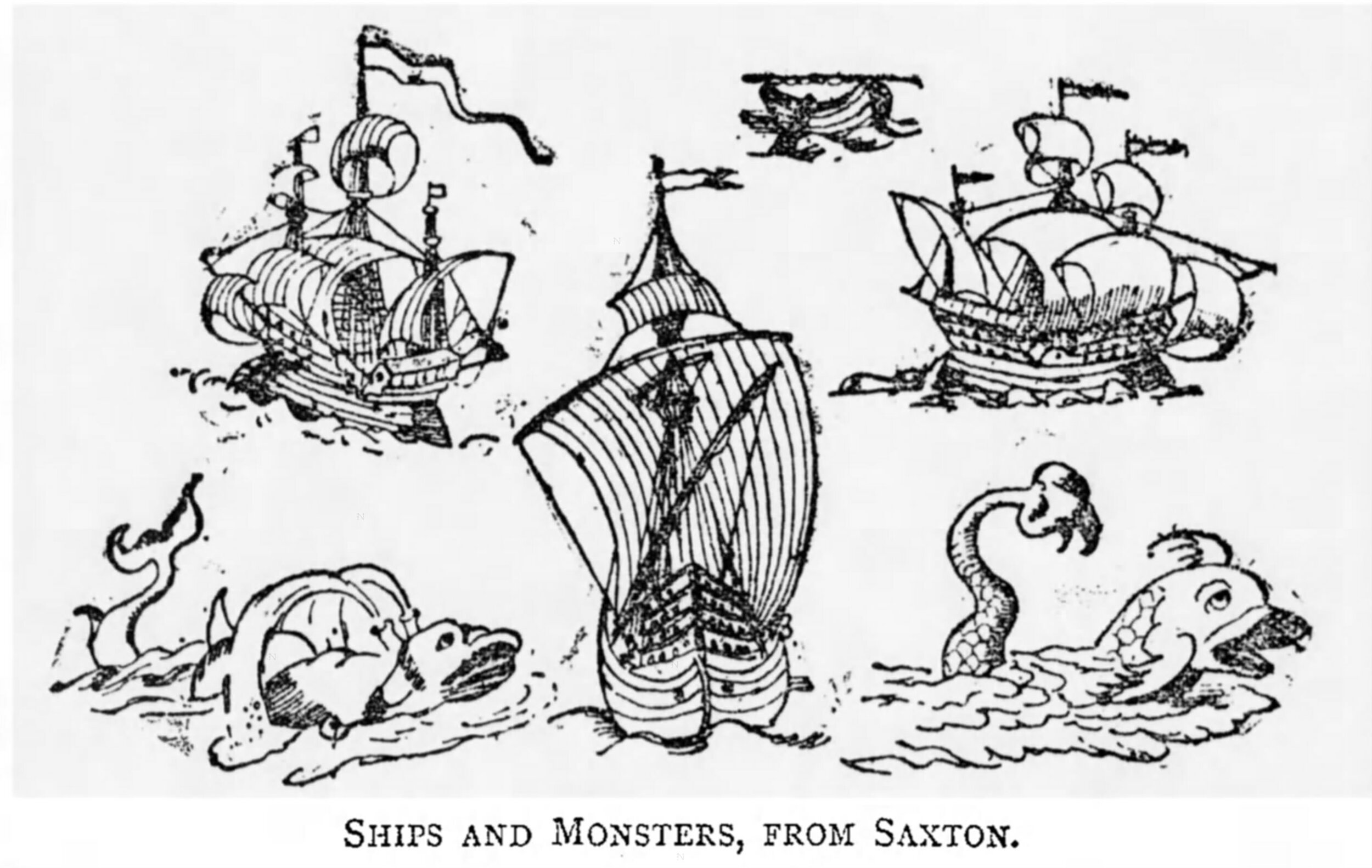
Christopher Saxton’s map of Cumberland, dated 1576, shows the west coast of the county bounded on one side by what might have been regarded as the perilous, uncivilized, ocean – complete with sea monsters – and a landscape to the east and south west that is dotted with strange-looking mounds (by the map engraver, Augustine Ryther) representing the actuality of a mountainous terrain that acted as a natural barrier between the towns and settlements on the coast and the low lying land to the west, and the rest of the county (and, of course, the county of Westmorland, which was joined to Cumberland in the new county of Cumbria).[iii]
Saxton’s map can be much admired as a historical artifact, if not for the skill and artistry that undoubtedly were involved in its creation. And even if, as historians today would suggest, the information highlighted on the map was not, even in its own day, to be regarded as existing entirely apart from artistic visions of place, the evidence as it was laid out and presented – often established ‘by taking compass-bearings from church towers or other high points’ – was nonetheless enough to determine, at the very least, a point of arrival for anyone who consulted and used the map as their guide.[iv] This was, to be sure, a place with a lot of mountains; but also a place that faced the sea.
The amalgamation of the counties in 1974 does not obscure the fact that Cumbria can be seen as a place with two distinctive – geographic and cultural – parts. Saxton’s map, as well as much of the modern history of coastal Cumbria, since the 17th century, marks the west of the county as a remote and, in many ways, isolated part of a larger region that itself was a strange and indeterminate place – a ‘lawless ambiguity’ for much of its history – often characterized as a rugged wilderness.[v] For those who ended up on the Cumbrian coast in the aftermath of its industrialization when urban life took root, Saxton’s seemingly exaggerated map would have probably been seen as quite accurately reflecting the basic truth of their situation. They must have felt not only hemmed in by the sea, but psychologically and physically constrained by the mountain barrier of the Lake District – stuck between two natural obstacles.
Notes
[i] Casey, Edward, ‘Place and Edge,’ in The Intelligence of Place: Topographies and Poetics, ed. Jeff Malpas (London, 2015)
[ii] See James Corner, ‘The Agency of Mapping: Speculation, Critique and Invention,’ in Mappings, ed. Denis Cosgrove (London, 1999).
[iii] Saxton’s maps have been published in a number of versions, but see: Christopher Saxton’s 16th Century Maps, with Introduction by William Ravenhill (Shrewsbury, 1992); D.K. Smith, The Cartographic Imagination in Early Modern England (Aldershot, 2008), pp. 41-72.
[iv] The quotation is from a review of An Atlas of England and Wales: The Maps of Christopher Saxton, engraved I574-1579. Introduction by Edward Lynam, in The Geographical Journal, Vol. 88, No. 6 (Dec., 1936), pp. 556-558. Review author name not given.
[v] Peter Davidson, The Idea of North (London, 2005), p. 224.